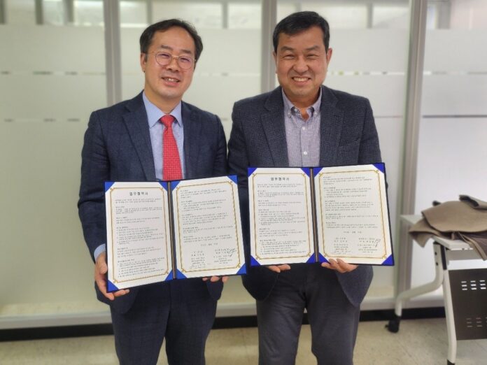
인공지능(AI) 드론 전문기업 가이온(대표이사 강현섭)이 공간정보기술(대표이사 박경열)과 드론 기반의 지리정보시스템(GIS) 사업 활성화를 위한 업무협약(MOU)을 체결했다고 밝혔다.
양사는 이번 협약을 통해 무인항공기와 GIS 기술을 융합하여 새로운 사업 기회를 창출하고, 기술 고도화를 공동 추진할 계획이다.
가이온은 무인항공기 관제 및 영상 분석 기술을 제공하는 한편, 공간정보기술은 GIS 솔루션 및 데이터 분석 역량을 지원하고 상호 보완적인 협력 모델을 구축할 예정이라고 밝혔다. 또한 이를 통해 무인항공기를 활용한 공간정보 데이터 수집 및 분석 기술을 발전시키고, 다양한 산업 분야에서 활용할 수 있는 첨단 정보 분석 서비스를 개발하는데 집중할 방침이다.
이외에도 양사는 자체적으로 갖추고 있는 기술력과 네트워크를 활용하여 공동 프로젝트 추진 및 사업 기획, 솔루션 고도화 등 다양한 협력 방안을 모색해 나갈 예정이라고 설명했다.
가이온 강현섭 대표는 “이번 협약을 통해 공간정보기술과 긴밀하게 협업해 무인항공기 기반의 GIS 사업 활성화 및 기술적 시너지를 창출할 것으로 기대한다”며 “앞으로도 무인항공기와 AI 기술을 활용한 혁신적인 데이터 분석 솔루션을 확대해 나가겠다”고 밝혔다.
- 관련 기사 더 보기
Gaion, Spatial Information Technology and Business Agreement Signed
Gaion (CEO Kang Hyeon-seop), an artificial intelligence (AI) drone specialist, announced that it signed a business agreement (MOU) with Spatial Information Technology (CEO Park Gyeong-yeol) to promote drone-based geographic information system (GIS) business.
Through this agreement, the two companies plan to create new business opportunities and jointly pursue technological advancement by combining drones and GIS technology.
Gaion said that while it will provide drone control and image analysis technology, its spatial information technology will support GIS solutions and data analysis capabilities and build a mutually complementary cooperation model. In addition, through this, it plans to focus on developing spatial information data collection and analysis technology using drones and developing advanced information analysis services that can be utilized in various industrial fields.
In addition, the two companies explained that they plan to explore various cooperation methods such as joint project promotion, business planning, and solution advancement by utilizing their own technological capabilities and networks.
Gaion CEO Kang Hyeon-seop said, “Through this agreement, we expect to work closely with spatial information technology to activate GIS businesses based on drones and create technological synergies,” adding, “We will continue to expand innovative data analysis solutions utilizing drones and AI technology.”
- See more related articles
ガイオン、空間情報技術と業務協定締結
人工知能(AI)ドローン専門企業ガイオン(代表取締役カン・ヒョンソプ)が空間情報術(代表取締役パク・ギョンヨル)とドローン基盤の地理情報システム(GIS)事業活性化のための業務協約(MOU)を締結したと明らかにした。
両社は今回の協約を通じて無人航空機とGIS技術を融合して新しい事業機会を創出し、技術高度化を共同推進する計画だ。
Gionは無人航空機の管制と映像分析技術を提供する一方、空間情報技術はGISソリューションとデータ分析能力を支援し、相互補完的な協力モデルを構築する予定だと明らかにした。また、これにより無人航空機を活用した空間情報データ収集及び分析技術を発展させ、多様な産業分野で活用できる先端情報分析サービスの開発に集中する方針だ。
他にも両社は、独自に備えている技術力とネットワークを活用して、共同プロジェクトの推進や事業企画、ソリューションの高度化など多様な協力案を模索していく予定だと説明した。
ガイオン・カン・ヒョンソプ代表は「今回の協約を通じて空間情報術と緊密に協業し、無人航空機基盤のGIS事業活性化および技術的相乗効果を創出すると期待する」とし「今後も無人航空機とAI技術を活用した革新的なデータ分析ソリューションを拡大していく」と明らかにした。
- 関連記事をもっと見る
Gaion 与空间信息技术及业务签署协议
人工智能(AI)无人机专家Gaion(首席执行官Kang Hyeon-seop)宣布与Spatial Information Technology(首席执行官Park Gyeong-yeol)签署了一份业务协议(MOU),以推动基于无人机的地理信息系统(GIS)业务。
通过该协议,两家公司计划结合无人机和 GIS 技术创造新的商业机会并共同追求技术进步。
Gaion表示将提供无人机控制和图像分析技术,而空间信息技术将支持GIS解决方案和数据分析能力,建立互补的合作模式。此外,我们计划借此重点推进利用无人机的空间信息数据收集和分析技术,开发可用于各个产业领域的先进信息分析服务。
此外,两家公司表示,计划利用各自的技术能力和网络,探索联合项目推广、业务规划、解决方案推进等各种合作方式。
Gaion 首席执行官 Kang Hyeon-seop 表示:“通过此次协议,我们希望与空间信息技术密切合作,激活基于无人机的 GIS 业务并创造技术协同效应,”并补充道,“我们将继续利用无人机和 AI 技术扩展创新数据分析解决方案。”
- 查看更多相关文章
Signature d'un accord commercial et technologique entre Gaion et l'entreprise
Gaion (PDG Kang Hyeon-seop), spécialiste des drones à intelligence artificielle (IA), a annoncé avoir signé un accord commercial (MOU) avec Spatial Information Technology (PDG Park Gyeong-yeol) pour promouvoir l'activité des systèmes d'information géographique (SIG) basés sur des drones.
Grâce à cet accord, les deux sociétés prévoient de créer de nouvelles opportunités commerciales et de poursuivre conjointement le progrès technologique en combinant les drones et la technologie SIG.
Gaion a déclaré qu'elle fournirait une technologie de contrôle des drones et d'analyse d'images, tandis que la technologie de l'information spatiale soutiendrait les solutions SIG et les capacités d'analyse de données, et construirait un modèle de coopération complémentaire. En outre, nous prévoyons de nous concentrer sur l’avancement de la technologie de collecte et d’analyse de données d’informations spatiales à l’aide de véhicules aériens sans pilote et de développer des services avancés d’analyse d’informations pouvant être utilisés dans divers domaines industriels.
En outre, les deux sociétés ont expliqué qu'elles prévoyaient d'explorer diverses méthodes de coopération telles que la promotion de projets conjoints, la planification commerciale et l'avancement de solutions en utilisant leurs propres capacités technologiques et réseaux.
Kang Hyeon-seop, PDG de Gaion, a déclaré : « Grâce à cet accord, nous espérons travailler en étroite collaboration avec les technologies de l'information spatiale pour activer les activités SIG basées sur les drones et créer des synergies technologiques », ajoutant : « Nous continuerons à développer des solutions d'analyse de données innovantes utilisant les drones et la technologie de l'IA. »
- Voir plus d'articles connexes
You must be logged in to post a comment.